

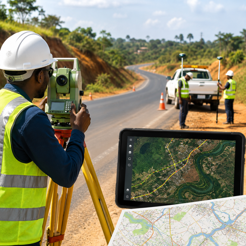
Temporary Road Survey & GIS Data Collection Jobs in Nigeria
The landscape of Nigeria is rapidly evolving, driven by an increasing population, rapid urbanization, and a renewed governmental focus on infrastructure development. As the nation expands its road networks to connect rural agricultural hubs to urban commercial centers, the demand for precise, actionable data has never been higher. This surge in infrastructural projects has created a massive wave of opportunities for professionals in the geospatial and civil engineering sectors, specifically giving rise to a booming market for temporary road survey and GIS data collection jobs in Nigeria.
For fresh graduates, experienced surveyors, and tech-savvy geographers, temporary or contract-based data collection roles offer a unique entry point into the dynamic world of spatial planning. These roles allow professionals to work on diverse projects across the 36 states and the Federal Capital Territory (FCT), build robust portfolios, and earn competitive compensation without being tied down to a single corporate desk. Whether it is tracking the degradation of the Lagos-Ibadan expressway or mapping entirely new road corridors in the North-East, Geographic Information Systems (GIS) and modern road surveying are at the very heart of Nigeria’s development master plan.
This comprehensive guide explores everything you need to know about temporary road survey and GIS data collection jobs in Nigeria. We will dive deep into the nature of the job, the essential skills and software required, the top organizations hiring, salary expectations, the challenges you might face in the field, and practical steps on how you can secure your next gig.
Understanding Road Surveys and GIS Data Collection
Before diving into the job market, it is crucial to understand the distinct but complementary fields of road surveying and GIS data collection. While they are often handled by the same individual or team on temporary projects, they represent different phases of infrastructural planning.




What is a Road Survey?
Road surveying is the physical measurement and mapping of the earth’s surface to determine the layout, elevation, and alignment of a proposed or existing road network. A road surveyor is responsible for determining the optimal route for a highway, assessing the topography of the land, and identifying potential obstacles such as rivers, steep gradients, or protected lands. In a country like Nigeria, where the terrain varies dramatically from the coastal swamps of the Niger Delta to the rocky outcrops of the Jos Plateau, accurate road surveying is the first line of defense against poor road construction and early structural failure.
What is GIS Data Collection?
Geographic Information Systems (GIS) represent the digital evolution of traditional surveying. GIS is a computer-based tool that captures, stores, analyzes, and displays geographically referenced information. In the context of road projects, GIS data collection involves gathering spatial data from the field using GPS devices, smartphones, tablets, or drones, and feeding this data into a digital mapping system. This data might include the exact coordinates of potholes, the location of drainage systems, traffic bottlenecks, and adjacent land use types.
When combined, road surveying provides the raw, physical measurements, while GIS provides the analytical framework to make sense of those measurements. A temporary GIS data collector working on a road project is essentially the bridge between the physical realities of the Nigerian terrain and the digital databases used by engineers and government planners.
Why the Shift Towards Temporary and Contract Roles?
You might wonder why many of these opportunities are advertised as temporary, short-term, or contract roles rather than permanent, full-time employment. The shift towards the gig economy and project-based hiring in the construction and geospatial sectors is driven by several practical factors in the Nigerian economy.
Project-Based Funding: Most road construction and rehabilitation projects in Nigeria are funded on a project-by-project basis by entities like the World Bank, the African Development Bank (AfDB), or federal agencies. Once the data collection phase of a specific road project (e.g., the Second Niger Bridge approach roads or the Abuja-Kano highway) is complete, the immediate need for a massive team of data collectors diminishes.
Cost Efficiency for Employers: Maintaining a large, permanent fleet of field surveyors and GIS analysts can be financially draining for private engineering firms. By hiring temporary staff during the critical data-gathering phase, companies can optimize their operational budgets.
Flexibility and Skill Diversity: Temporary roles allow organizations to hire specialists for very specific terrains. For instance, a surveyor who specializes in the swampy terrains of Bayelsa State might be hired on a short-term contract specifically for a Niger Delta road project, while another expert with experience in arid regions might be contracted for a project in Sokoto.
The Scope and Economic Importance of Road Surveys in Nigeria
Nigeria boasts the largest road network in West Africa, estimated at over 195,000 kilometers. However, a significant portion of this network remains unpaved or in a state of disrepair. The economic impact of poor road infrastructure cannot be overstated. It leads to increased transportation costs for agricultural produce, delays in the delivery of goods and services, and a higher rate of road traffic accidents.
To combat this, government agencies are continuously embarking on rehabilitation exercises. The foundation of any successful road rehabilitation is accurate data. Without knowing the exact depth of a gully erosion site on a federal highway or the structural integrity of a bridge, contractors cannot accurately estimate the volume of asphalt needed or the engineering interventions required.
This is where temporary GIS data collectors and road surveyors become indispensable. They are the eyes and ears on the ground. By mapping out the current state of infrastructure using geospatial tools, they provide the empirical evidence that the government and private contractors need to allocate budgets efficiently, design durable roads, and monitor the progress of construction over time.
Core Responsibilities of a Field GIS Data Collector and Road Surveyor
Working as a temporary road surveyor or GIS data collector is a hands-on, dynamic, and sometimes grueling job. It is not a role for those who prefer to sit behind a desk from 9 to 5. Below are the core duties you will be expected to perform when you secure a contract on a Nigerian road project:
- Field Data Gathering: This is the primary responsibility. You will travel to designated road networks to collect spatial and attribute data. This could involve walking kilometers of road to map potholes, failed sections, drainage blockages, and road signs.
- Equipment Calibration and Operation: You must ensure that all surveying and GIS equipment—such as Real-Time Kinematic (RTK) GPS receivers, total stations, and mobile data collection tablets—are fully charged, calibrated, and functioning correctly before heading out to the field.
- Digitizing and Mapping: After collecting raw data points, you will often be required to input these coordinates into GIS software to create digital representations (maps) of the road networks. This helps in visualizing the project scale for engineers.
- Topographic and Boundary Assessment: For new road projects, you will map out the natural contours of the land (topography) and verify land boundaries to ensure the proposed road does not encroach on private property or protected environmental reserves without proper documentation.
- Community Liaison: In Nigeria, surveyors are often the first point of contact between a construction project and the local community. A data collector must briefly explain their mission to community leaders (Baales, Emirs, or youth leaders) to ensure a peaceful working environment and avoid the infamous “Omo Onile” (land grabber/host community) disputes.
- Data Cleaning and Reporting: Field data is rarely perfect. You will spend your evenings cleaning up erroneous GPS points, removing duplicate entries, and preparing comprehensive daily or weekly reports for the project manager.
Essential Tools and Software Used in the Field
To be competitive in the temporary road survey and GIS job market in Nigeria, you must be proficient with the standard tools of the trade. The industry has moved far beyond simple paper maps and measuring tapes. Today, the profession is highly digitized.
Hardware Tools
Global Positioning System (GPS) Receivers: Specifically, RTK (Real-Time Kinematic) GPS devices are heavily used in road surveying because they offer centimeter-level accuracy, which is crucial for engineering designs. Handheld GPS devices like Garmin are also used for less precise reconnaissance surveys.
Total Stations and Theodolites: These are optical instruments used in modern surveying and building construction for measuring both vertical and horizontal angles, as well as the sloping distance from the instrument to a particular point.
Unmanned Aerial Vehicles (UAVs) / Drones: Drone mapping is revolutionizing road surveys in Nigeria. Drones equipped with high-resolution cameras and LiDAR (Light Detection and Ranging) sensors can survey miles of inaccessible or dangerous road networks in a fraction of the time it would take a human on foot.
Mobile Tablets and Smartphones: Rugged tablets are the modern surveyor’s notebook. They are loaded with mobile GIS applications that allow for real-time data entry in the field.
Software and Applications
ArcGIS Suite: Developed by Esri, ArcGIS (including ArcGIS Pro and ArcGIS Online) is the industry standard for mapping and spatial analysis. Most high-paying contract jobs will require proficiency in ArcGIS.
QGIS (Quantum GIS): This is a highly powerful, open-source alternative to ArcGIS. Many NGOs and cost-conscious engineering firms in Nigeria prefer QGIS because it is free yet incredibly versatile for vector and raster data analysis.
Data Collection Apps (ODK, KoboToolbox, Survey123): Open Data Kit (ODK) and KoboToolbox are massively popular in Nigeria for field data collection, especially in off-grid areas with no internet connection. You must know how to design digital forms, deploy them to mobile devices, and extract the data.
AutoCAD Civil 3D: While primarily an engineering design software, surveyors must often export their spatial data into AutoCAD formats (like .DWG or .DXF) for the civil engineers to begin their road designs.
Top Organizations Hiring for These Roles in Nigeria
Knowing where to look is half the battle when hunting for temporary road survey and GIS jobs. The employment ecosystem in Nigeria consists of a mix of government agencies, massive multinational construction firms, and specialized non-governmental organizations.
1. Federal Roads Maintenance Agency (FERMA)
FERMA is the apex federal agency tasked with the monitoring and maintenance of all federal roads in Nigeria. Because road degradation is continuous, FERMA regularly engages independent consultants, ad-hoc staff, and short-term data collectors to conduct nationwide road condition surveys. These surveys dictate the agency’s maintenance budget for the fiscal year. You can keep an eye on their official portal to get started or check for periodic recruitment announcements: Official FERMA Website.
2. Federal Ministry of Works
While FERMA handles maintenance, the Federal Ministry of Works handles the construction of entirely new road infrastructure and major rehabilitation projects. The ministry often awards these mega-contracts to large engineering firms, but they also hire independent GIS consultants to monitor project execution and verify the data submitted by contractors.
3. Major Private Construction Companies
Multinational and indigenous construction giants are the biggest employers of temporary surveyors. Companies like Julius Berger Nigeria Plc, Hitech Construction Company, Craneburg Construction, and Reynolds Construction Company (RCC) frequently win multi-billion Naira road contracts. Whenever they secure a new corridor, their first step is a massive topographic and GIS survey, leading to a spike in short-term hiring.
4. State Geographic Information Systems
Various state governments have established their own spatial data agencies to manage land administration and urban planning. Examples include the Lagos State Geographic Information System (LAGIS), Kaduna State Geographic Information Service (KADGIS), and Edo State Geographic Information Service (EDOGIS). These agencies frequently hire temporary enumerators and data collectors to map state roads, properties, and utilities.
5. NGOs and International Development Agencies
Organizations like the World Bank, USAID, eHealth Africa, and various agricultural NGOs often fund rural access mobility projects (such as the Rural Access and Agricultural Marketing Project – RAAMP). These projects aim to connect rural farms to urban markets. NGOs regularly hire temporary GIS data analysts to map out these rural road networks to measure the socio-economic impact of road connectivity on local communities.
Top Skills and Qualifications Required to Land These Jobs
The competition for high-paying GIS and surveying contracts in Nigeria is fierce. To stand out, you need a robust blend of formal education, technical prowess, and essential soft skills.
Educational Background
Most employers require at least a Bachelor’s degree (B.Sc.) or a Higher National Diploma (HND) in relevant fields. The most sought-after disciplines include:
- Geoinformatics and Surveying
- Geography and Regional Planning
- Civil Engineering
- Environmental Science
- Urban and Regional Planning
Additionally, having a master’s degree in Geographic Information Systems or a professional certification from bodies like the Surveyors Council of Nigeria (SURCON) or the Nigerian Institution of Surveyors (NIS) provides a massive advantage, especially for managerial or senior supervisory contract roles.
Technical and Analytical Skills
As discussed in the software section, you must be technically fluent. You need the ability to query spatial databases, perform spatial interpolations, and create visually compelling maps that tell a story. If an employer asks you to overlay a proposed road alignment on a flood-risk map of Lokoja, you should be able to execute that seamlessly using ArcGIS or QGIS.
Physical Stamina and Adaptability
This is not a job for the faint of heart. Temporary road surveys in Nigeria often require walking for miles under the scorching sun or navigating muddy, flooded terrains during the rainy season. You must be physically fit, adaptable to harsh living conditions (as projects are often located in remote villages with poor amenities), and capable of carrying heavy surveying equipment across difficult landscapes.
Attention to Detail
In road surveying, a miscalculation of a few centimeters can lead to disastrous engineering failures, poor drainage, and massive financial losses. A top-tier data collector is meticulous, constantly double-checking coordinates, elevations, and attribute data before submission.
Salary Expectations and Working Conditions
One of the most attractive aspects of temporary road survey and GIS data collection jobs is the compensation. Because these roles are critical, project-bound, and often physically demanding, contractors are usually willing to pay premium rates.
Compensation Breakdown
Salaries for these roles vary widely based on your level of experience, the duration of the contract, the complexity of the project, and the hiring organization.
- Entry-Level / Field Enumerators: Fresh graduates or those with less than two years of experience using tools like KoboToolbox or handheld GPS devices can expect to earn between ₦100,000 and ₦200,000 per month on temporary contracts. Some projects pay a daily rate ranging from ₦5,000 to ₦10,000.
- Mid-Level GIS Analysts / Surveyors: Professionals who can operate total stations, process drone imagery, and run complex spatial analyses on ArcGIS typically command between ₦250,000 and ₦500,000 per month.
- Senior GIS Managers / Lead Surveyors: Those managing entire field teams, liasing with government clients, and designing the geospatial databases can earn upwards of ₦600,000 to over ₦1,000,000 per month for the duration of the contract.
Allowances and Perks
Beyond the base salary, temporary field workers in Nigeria are usually entitled to several allowances.
- Transport Allowance (T&T): To cover the cost of moving from your home state to the project site.
- Accommodation and Per Diem: Employers typically provide guesthouses or pay a daily feeding and accommodation stipend if you are deployed outside your city of residence.
- Hazard Pay: If the survey is taking place in areas with known security challenges or extremely harsh environmental conditions, companies often add a hazard premium to the daily rate.
Working Conditions
The working conditions can be unpredictable. You might spend three weeks in the heart of a bustling city like Lagos, dodging heavy traffic while trying to map drainage systems, and the next two months in a remote rural village in Taraba state with limited internet access. Work days start very early—often by 6:00 AM—to take advantage of the morning weather before the afternoon sun becomes unbearable.
Challenges Faced by GIS Data Collectors in Nigeria
While the job is rewarding, working as a temporary road surveyor and GIS data collector in Nigeria comes with a unique set of infrastructural and socio-cultural challenges. Being aware of these hurdles is the first step toward overcoming them.
1. Security Concerns
Security is arguably the most significant challenge for field workers in Nigeria today. Certain regions are prone to banditry, kidnapping, and communal clashes. Mapping roads in these volatile areas requires extreme caution, constant communication with local security agencies, and sometimes working under the protection of armed military or police escorts. Employers are increasingly relying on satellite imagery and drone surveys to minimize human exposure in high-risk red zones.
2. The “Omo Onile” Phenomenon and Community Hostility
Particularly in the southern regions of Nigeria, surveyors frequently encounter local community youths or land speculators (commonly referred to as “Omo Onile” in the South-West). These groups often demand illegal levies before allowing surveyors to set up their tripods or fly their drones. Managing these situations requires deep emotional intelligence, diplomacy, and sometimes the intervention of local chiefs to explain that the project is for the communal good.
3. Harsh Weather and Rugged Terrains
Nigeria’s climate can be extreme. During the peak of the rainy season (June to September), flash floods can wash out access roads, making it impossible to reach survey sites. Conversely, during the dry harmattan season, thick dust reduces visibility, which can interfere with the optical lenses of surveying equipment and drone cameras. Protecting delicate electronic equipment from extreme heat and moisture is a daily struggle.
4. Poor Internet Connectivity and Power Supply
GIS data collection relies heavily on technology. However, many remote Nigerian communities lack stable electricity and mobile network coverage. Field workers must invest in heavy-duty power banks, solar chargers, and multiple SIM cards from different network providers. They often have to collect data offline during the day and drive miles to the nearest town at night just to sync their data to the cloud servers.
Step-by-Step Guide on How to Apply for Temporary Road Survey & GIS Jobs in Nigeria
Ready to jump into the field? Landing your first or next contract job requires a strategic approach. Here is a step-by-step guide to positioning yourself for success in the Nigerian geospatial job market.
Step 1: Build a Specialized, Field-Oriented CV
Generic resumes do not work well for technical contract roles. Your CV must explicitly highlight your field experience. Do not just list “Data Collection.” Specify the tools you used. For example: “Led a team of 5 enumerators using KoboToolbox and Garmin GPS to map 50km of rural roads in Ondo State, resulting in a 99% data accuracy rate.” Emphasize your physical readiness and willingness to travel extensively.
Step 2: Create a Geospatial Portfolio
As a GIS professional, your maps speak louder than your words. Create an online portfolio (using platforms like GitHub, Behance, or a personal blog) showcasing projects you have worked on. Include snippets of spatial analysis, topographic maps, and dashboards you have created. If you are a fresh graduate, use open-source data to map a local problem (like traffic congestion in your city) and add it to your portfolio to prove your competence.
Step 3: Leverage Nigerian Job Portals and LinkedIn
Many short-term recruitment drives are posted on popular Nigerian job boards such as MyJobMag, Jobberman, and HotNigerianJobs. Set up daily email alerts for keywords like “GIS Analyst,” “Data Collector,” “Surveyor,” and “Geomatics Engineer.”
LinkedIn is arguably the most powerful tool for this niche. Optimize your LinkedIn profile with these keywords. Follow the HR managers of major construction companies like Julius Berger and Hitech Construction. Follow NGOs and development organizations like eHealth Africa, which frequently hire temporary GIS coordinators across different states.
Step 4: Register with Professional Bodies
Networking is critical. Join the Nigerian Institution of Surveyors (NIS) or the Geoinformation Society of Nigeria (GEOSON). Attend their annual conferences and state chapter meetings. Many contract roles are never advertised publicly; they are shared via word-of-mouth among registered professionals within these networks.
Step 5: Stay Alert for Government Announcements
Agencies like FERMA and the National Bureau of Statistics (NBS) occasionally announce nationwide recruitment exercises for temporary field workers. Follow their official social media handles and regularly check their portals so you can apply early before the application window closes.
Future Trends of GIS and Road Surveying in Nigeria (2026 and Beyond)
The field of geospatial data collection is undergoing a massive technological revolution globally, and Nigeria is rapidly catching up. If you plan to build a long-term career leveraging temporary contracts, you must stay ahead of these emerging trends.
The Rise of Drone Mapping and LiDAR
Traditional surveying on foot is gradually being replaced by Unmanned Aerial Vehicles (UAVs). Drones equipped with LiDAR technology can penetrate dense forest canopies to map the bare earth below, which is incredibly useful for planning new roads through the thick forests of southern Nigeria. Getting a drone piloting license from the Nigerian Civil Aviation Authority (NCAA) will make you an incredibly hot commodity in the job market.
Cloud GIS and Real-Time Collaboration
The days of storing spatial data on a single hard drive are over. The industry is moving towards Web GIS. Using platforms like ArcGIS Online, data collected by a temporary surveyor in rural Borno state can be instantly viewed, analyzed, and approved by a project manager sitting in a corporate office in Abuja or Lagos. Familiarity with cloud database management is becoming a mandatory requirement.
Artificial Intelligence in Spatial Analysis
Artificial Intelligence (AI) and Machine Learning are beginning to play a role in Nigerian road maintenance. Future GIS systems will use AI algorithms to automatically analyze drone imagery, identify potholes, and predict which sections of a road are most likely to fail during the next rainy season. Understanding how to integrate AI tools with traditional GIS will set you apart from the crowd.
Conclusion
Temporary road survey and GIS data collection jobs in Nigeria offer an exciting, lucrative, and highly impactful career path. As the government and private sector continue to pump billions of Naira into bridging the country’s infrastructural deficit, the demand for competent spatial data professionals will only continue to rise.
By mastering the necessary hardware, becoming fluent in industry-standard software like ArcGIS and QGIS, and preparing yourself physically and mentally for the rigors of the Nigerian terrain, you position yourself at the forefront of the nation’s development. Update your CV, refine your technical skills, start networking with industry leaders, and take the bold step toward securing your next big contract in the geospatial industry.